Architecture (MA)

Tom Hunter

Tom is a Welsh designer currently based in London. His work seeks to interrogate the relationships between self-identity, technology and architecture within environments of late-stage capitalism.

Within the RCA, Tom’s work has explored: the influence of the cowboy archetype and the digital frontier on contemporary masculine identity, the ethical dilemmas of digitised livestock within industries of agriculture and the role of memory, language and unconscious bias in our recollection of family histories.

Prior to the RCA, Tom graduated from Oxford Brookes University before going on to work in both Architecture offices and Architecture publication.

a map of the world as depicted in the bible in the moment before the great flood, edward quinn, 1830

As hegemonic forms of cartography have become more precise, mapping has become an act no longer synonymous with exploration and understanding. Rather, it has become a tool for ruling powers to exact control over space and the peoples who inhabit it. If the map is a limit of what we know; this project seeks to question how alternate forms of human-centered and self-centered media might be used to generate new understandings of space, place and human experience.

From these new-cartographical techniques, the work seeks to re-map, re-explore and re-understand the territorial limits of The Shankill Road and The Falls Road in West Belfast. Since 1969, these communities have found themselves physically divided by Belfast’s longest military “peace line”. Initially drawn as a line on a map by City Council members and the British Army during the emergence of the conflict that would become The Troubles; the peace line was, and is, intended to defend and segregate the communities from one another. This limit-scenario has only exacerbated social and economic decline within the area, as well as further entrenching sectarian divides and the perceived necessity for paramilitary action against each other as well as forces of the state.

Through identifying the existing architecture of the peace-line as an already failed attempt of militant architectural solutionism, the project rejected conventional architectural practice and sought to challenge top-down design methodologies. By grounding the project in a personal research-based design process, influenced by notions of human-centred and self-centred media such as photo portraits and family photographs, a multidirectional understanding of individual, familial and community histories of the Shankill and The Falls was formed. This process produced new methodologies of forming space from otherwise flat media types, birthing so-called ‘paradisal landscapes’. Culminating in a propositional ‘paradise’ residing within the structure of the peace line itself, an interface between The Shankill and The Falls.


a photograph of three woman stood at the bottom of a garden, it looks weathered.
[July 1972] Emma Hunter is photographed standing in her newly built garden in the Glencairn Estate, Belfast, NI. She has just been forcibly removed from her former home on the Shankill Road as it has been deemed a slum-dwelling by the council. Concurrently, sectarian violence in Belfast between Protestant and Catholic communities is at its peak.
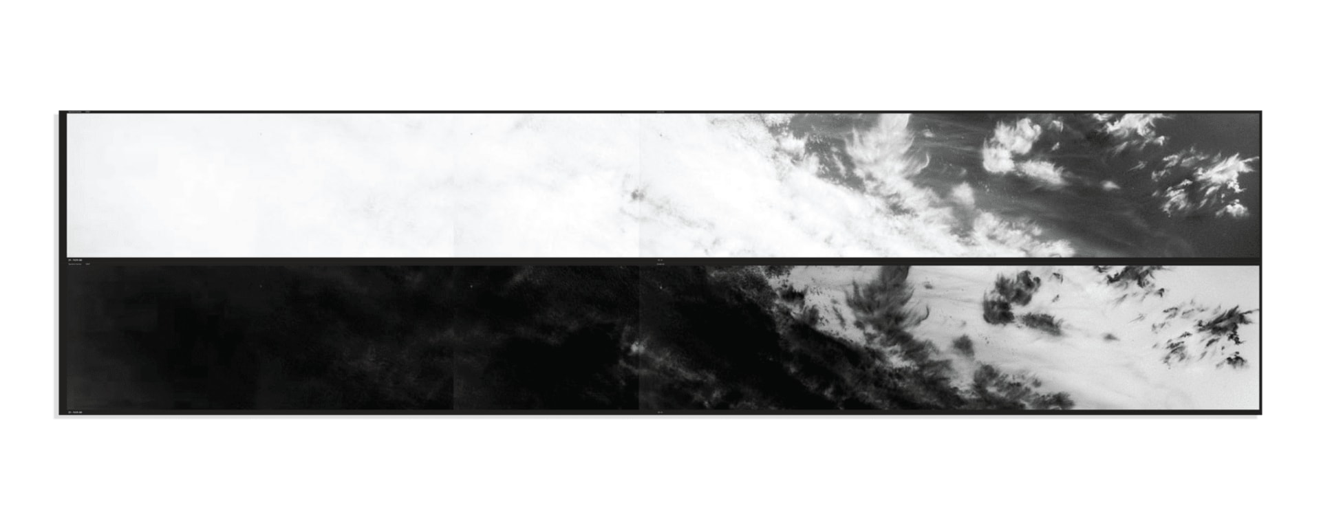
a photograph and a photonegative showing clouds as seen by the CIA's KH-9 spy satellite
[29 November 1980] Unbeknownst to Emma, 180km above her head was the Cia’s KeyHole-9 spy satellite. Primarily designed to photograph soviet military installations. Key Hole 9 was the first satellite to photograph the entire landmass of the earth. Yet of all the publicly accessible images taken above Belfast there is not a single mapping of the city. Instead there are 169 photographs of clouds. This is a result of all clear day images being passed from the CIA to the British military and security forces.
a military driver's document holder. Inside it is a map with a red line on it
[14 August 1969] Beneath the clouds of Belfast, as the conflict that would become known as the Troubles raged. The council and the British army drew a line on a map and from it a 5km long military wall was constructed within the heart of the city. Physically cutting streets, gardens and homes. A so-called peace line to divide the protestant Shankill Road in the North, Emma’s former home, from the Catholic Falls Road in the South in an attempt to quell sectarian violence between the communities.
two grainy images of men wearing balaclavas
Contemporarily, the communities of the Shankill and the Falls have been demonised and largely ignored by local government due the areas links to paramilitary organisations whose murals continue to adorn the facades of buildings in both neighbourhoods. Recent investigations show that City councillors have purposely ignored calls from residents to discuss the future presence of the peace lines, as the walls help to maintain political gerrymandering and religious division.
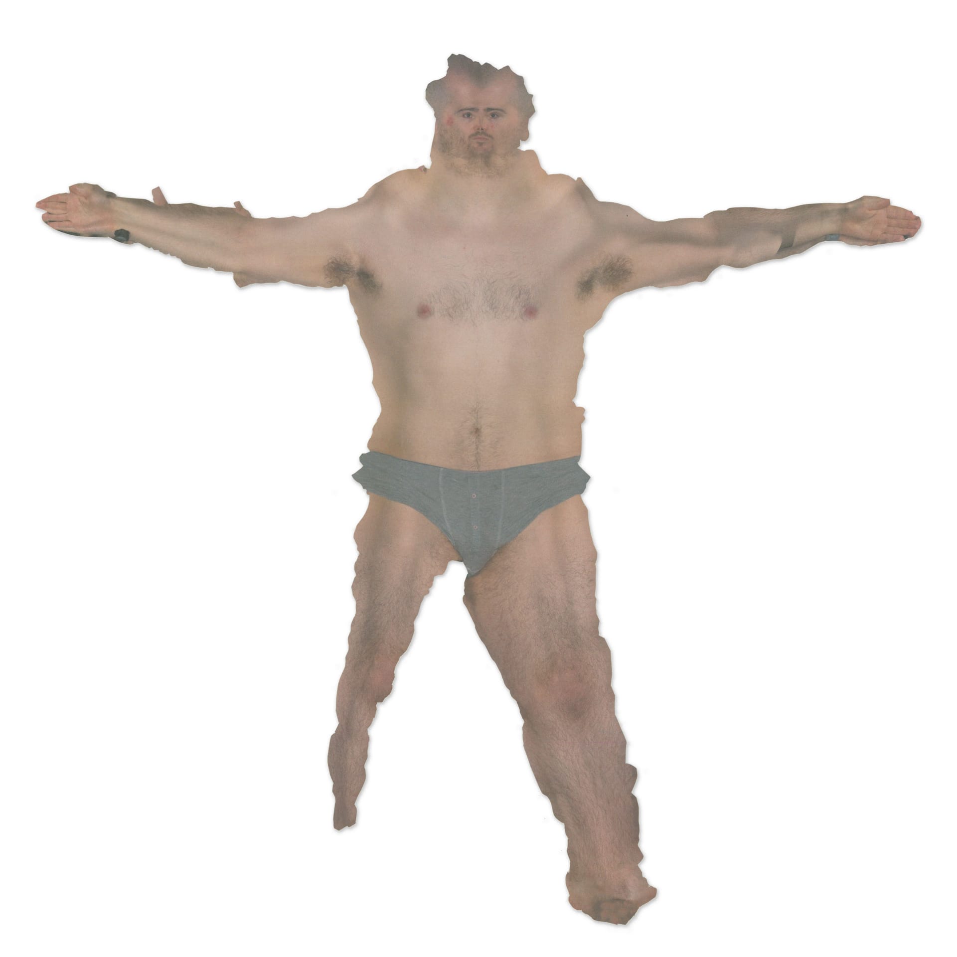
the unwrapped and flattened skin of tom hunter
[23 November 2022] To counteract top-down media forms such as the satellite image I wanted to question how we might move past the limited notion of the map and how other ways of seeing and being seen may help me to formulate my own understanding of the Shankill and the falls.
a scan of tom hunters leg
What might human centred and self-centered forms of media teach us about space and architecture? How might the orthographic flattening and study of the self aid in finding new depictions, new connections and new understandings of ourselves and of others?
selection of work surrounding prison photo studios
[2012-2022] It was within the visitation photographs of inmates of the US penitentiary system that I found what I perceive to be one the most poignant forms of physical photo studios that still remain in use. Designed and run by inmates, these ad-hoq studios offer their community a momentary opportunity for self expression and escape from confinement. These often depict natural ideals of beauty, grassy landscapes, calm beaches and waterfalls, what I defined as landscapes of paradise.
 
Moving from the orthography of the map, to the perspective, I looked to discover not only how these studios are set-up and function within existing prison spaces but also, through digital and ai processes I wanted to understand what it would be like to physically step into one of these backdrops. In doing so a painterly landscape of stretched interwoven planes was created. A pocket dimension of impossible paradisiacal space. Original image credit: Alyse Emgur’s, Prison Landscapes, 2012
axo
flat flyover
[7 December 2022] Through this methodology of unfolding imagery the photograph of Emma standing in her garden was spatialised into a paradisal landscape. The memory captured in the photograph formed a new satellite image, one that imagined Belfast that day beneath the clouds.
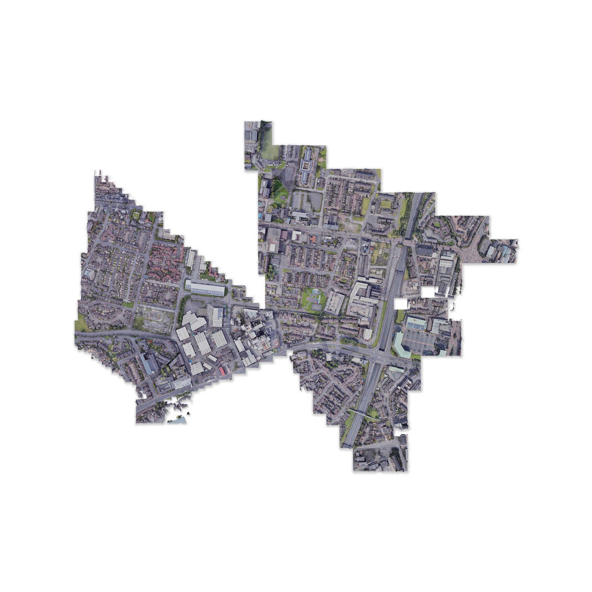
Distorted map of geometry stolen from google maps depicting west belfast
[23 February 2023] In order to locate potential sites of intervention within The Shankill-Falls peace line geometry was stolen and extracted from Google Maps. This geometry allowed for a forensic examination of the peace line and the urban landscape it divides. From this exercise sites of depth were found within the line.
 
a 'found' elevation of the proposed site. Designated the name Section 17
[19 April 1999] A found military document showing an elevation of the intervention site between Cupar Way and Conway Street. The elevation designates the site as 'Section 17' of the Shankill-Falls peace line, a former observation post.
invite
section of the shankill-falls paradise
Section detailing the spaces found within the proposed Shankill-Falls Paradise.
plan of the shankill-falls paradise
Plan detailing the proposed Shankill-Falls Paradise. Overlay denotes existing wall elements which are encased within the proposed paradise.
door schedule for the shankill-falls paradise
Door Schedule for the proposed Shankill-Falls Paradise.
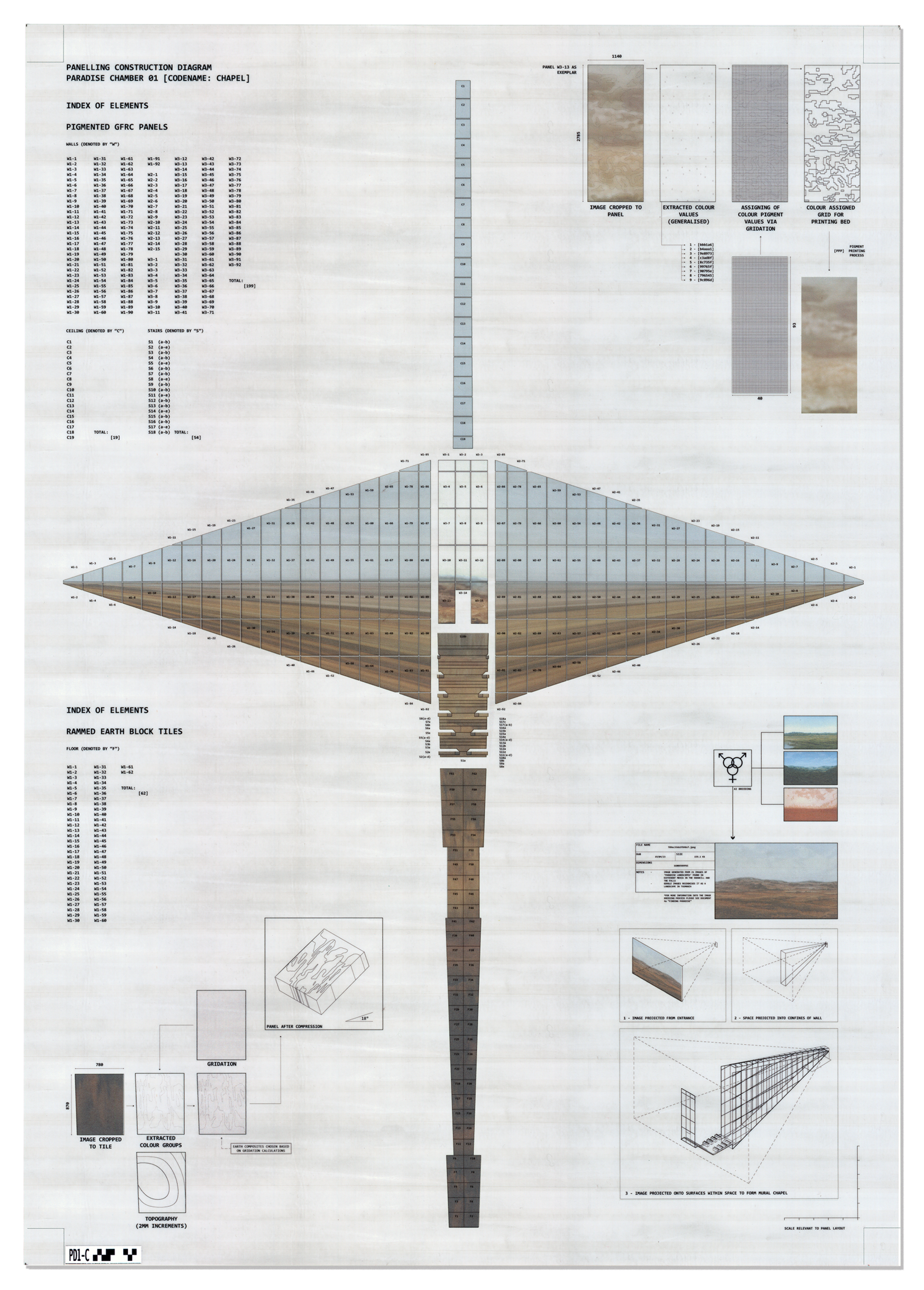
panel diagram for paradise 01: the chapel
Panelling Diagram for Paradise 01: 'The Chapel'. These bespoke printed concrete panels depict a projected paradisal landscape generated from landscapes depicted in murals around The Shankill and The Falls.
panel diagram for pradise 02 the garden
Panelling diagram for Paradise 02: 'The Garden'.
render of the bottom of the garden
[21 May 2025] The bottom of the garden.
render of the S-F gates open
[17 August, 2026] The blast doors of the Shankill Falls Paradise are held open, allowing people to pass from The Shankill to The Falls.